



Ahmedabad: On July 23, rainfall of 177mm in two hours paralysed Ahmedabad. By the day’s end, total rainfall had reached between 278mm and 294.6mm — the fourth-highest single-day total recorded in nearly 100 years.Urban planners and geoinformatics specialists argue the resultant flooding was the consequence of decades of lapses.The experts said encroachment approvals, delayed planning schemes, and the systematic destruction of natural waterbodies played a part in marooning Ahmedabad in helplessness.Besides, the experts said, the city has a drainage network that could never keep up with the demands of booming development.
CJP Jantar Mantar Protest Updates
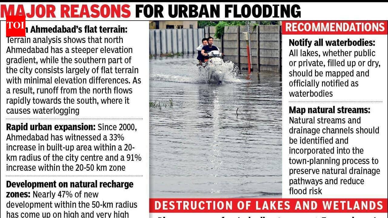
More than 300 locations across western Ahmedabad were flooded on July 23. Knee-to-waist-deep water trapped residents across 150 societies.A report by Gujarat’s urban development and housing department points to structural failure.Since 2000, Ahmedabad’s built-up area has expanded by 33% within a 20-km radius of the city centre.In the 20-50km outer ring — the expanding western and southern suburbs — the increase is a staggering 91%. Critically, 47% of all new development across the 50-km range has been constructed directly on high and very high groundwater recharge zones.These lands’ primary ecological function is to absorb rainfall before it reaches roads, drains and homes.Another report, a 2022 study titled “Study of Flash Floods: Case Study of Ahmedabad”, published in Cept University’s Portfolio section by C Raj Deepankar of the geoinformatics department, said that the “North of Ahmedabad is having elevation of less than 69-88 degrees. While the southern part of Ahmedabad is a flat surface.”The study added, “Most waterlogging complaints are from south of Ahmedabad. The terrain in the south is plain land with little elevation.”Water drains northward along the city’s natural gradient. The south — flat, low-lying, and historically the fastest-growing residential belt — sits at the bottom of that gradient with no natural escape route.Many areas, including Anandnagar Road, Manekbaug Road, the 132-Feet Ring Road and Judge’s Bungalow Road, became impassable during the torrential spell that began on July 23.Delayed opening of the Vasna Barrage gates on the Sabarmati increased floodwaters across western and southern zones.The city’s lakes — its secondary line of defence — have been methodically erased. According to the same Gujarat urban development report, lakes in Bodakdev and Naroda have vanished entirely, reclaimed and paved over as land parcels.Where waterbodies survive, their surface area has contracted sharply. Sola lake has lost 53% of its water spread. Vastrapur lake has shrunk by 10%.Similar reductions have been recorded in Memnagar and Thaltej. Both Thaltej and Sola lakes continue to face active encroachment due to the absence of protective intervention.Municipal commissioner Banchha Nidhi Pani defended the city’s response. “Water has completely gone from the roads,” he said.On the severe inundation in Bopal and Ghuma, he described their topography as “saucer depressions” where water naturally pools.He said, “Bopal and Ghuma entered the municipality in 2007 as fully developed areas,” leaving them dependent on a gram panchayat-era storm network.


