


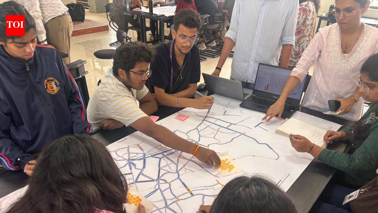
Bengaluru: Weeks before the Supreme Court reaffirmed pedestrians’ right to safe footpaths and Karnataka launched its pavement reclamation drive in Bengaluru, Greater Bengaluru Authority (GBA) had already begun a city-wide effort to map arterial and sub-arterial roads, laying the groundwork for data-driven improvements to pedestrian infrastructure.Since March, GBA has been conducting a GIS-based survey of Bengaluru’s 1,300km arterial and sub-arterial road network to create a “Street Atlas” that can power city decisions with data. Officials describe this as the city’s first comprehensive digital database of road and pedestrian infrastructure.The exercise, carried out in partnership with urban planning organisation Sensing Local and support from WRI India and the Sustainable Mobility Network (Bengaluru), is expected to provide a baseline for future infrastructure planning and investment. Data shows over 750km of roads have already been surveyed. As both sides of every road are assessed independently, nearly 1,500 km of footpaths have been profiled so far.The findings suggest the primary challenge is not always the availability of space for pedestrians, but the condition of the infrastructure itself.Around 680km of the surveyed footpaths are wider than 2.5 metres, indicating that most major roads have adequate space for pedestrians. However, the survey found widespread problems with broken pavements, missing stretches, encroachments and other obstacles.Survey teams are documenting carriageway dimensions, pavement height and surface material, pedestrian crossings, bus shelters, public toilets, skywalks, streetlights, signage, bollards, tactile paving for the visually impaired, traffic islands, medians, seating, shade and other roadside features.Data is collected at 100-metre intervals and will be uploaded to a dedicated digital platform. GBA chief engineer (planning and co-ordination) Hemalatha K said the survey is expected to conclude by the end of July. “This will become the city’s baseline GIS layer for road infrastructure. We have already mapped works taken up under various grants, and this database will help us plan future infrastructure more effectively by identifying where interventions are needed and ensuring optimal utilisation of funds,” she said.Students lead the wayThe fieldwork was carried out by students from BMS college of Architecture, Dayanand Sagar College of Architecture, RV College of Architecture, SJB School of Architecture and Planning, NITTE, Acharya NRV School of Architecture, Sir MV School of Architecture and Christ University Yeshwantpur campus.Each volunteer was assigned six road stretches and equipped with measuring wheels to record street-level data at their convenient time.Officials say the initiative is intended to create Bengaluru’s first open-source GIS database for road and pedestrian infrastructure. The data is expected to provide researchers, planners and citizen groups with a common reference to track changes, identify gaps and contribute to improving the city’s walkability and accessibility.“The exercise exposed us to the realities pedestrians face, even in well-developed areas where footpaths are poorly designed. As architecture students, it helped us think beyond buildings and consider how streets can be made more pedestrian-friendly,” said Kaustubh Prashant Soni, a III Year B.Arch student, BMS College of Architecture.“After a brief training and demonstration, I surveyed roads around Magadi Road. It was rewarding to contribute to an initiative that can help improve footpaths and pedestrian safety,” added Tharun G, III Year B.Com student, Christ University Yeshwanthpur.The survey went beyond simply mapping streets. “We documented details such as whether streetlights served pedestrians or vehicles. It also gave me a chance to explore unfamiliar parts of Bengaluru and view the city from a walkability perspective,” said Kishorenath Vendan, a IV Year B.Arch student, RV College of Architecture.“The exercise showed me how cities function on the ground. I learnt to see streets as integrated systems where good urban design is about making them safe, accessible and comfortable for everyone, not just moving traffic efficiently. We also carried out junction audits,” said another student Dara Nihal Jagadeesh, I Year B.Arch, BMS College of Architecture.Walking changes how we experience Bengaluru, said Shreya Srihari, IV Year B.Arch student, RV College of Architecture. “It helps us notice heritage buildings, parks and neighbourhoods in ways we miss when travelling by vehicle. Better walkability can strengthen people’s connection with the city and encourage them to value and improve public spaces.”


