






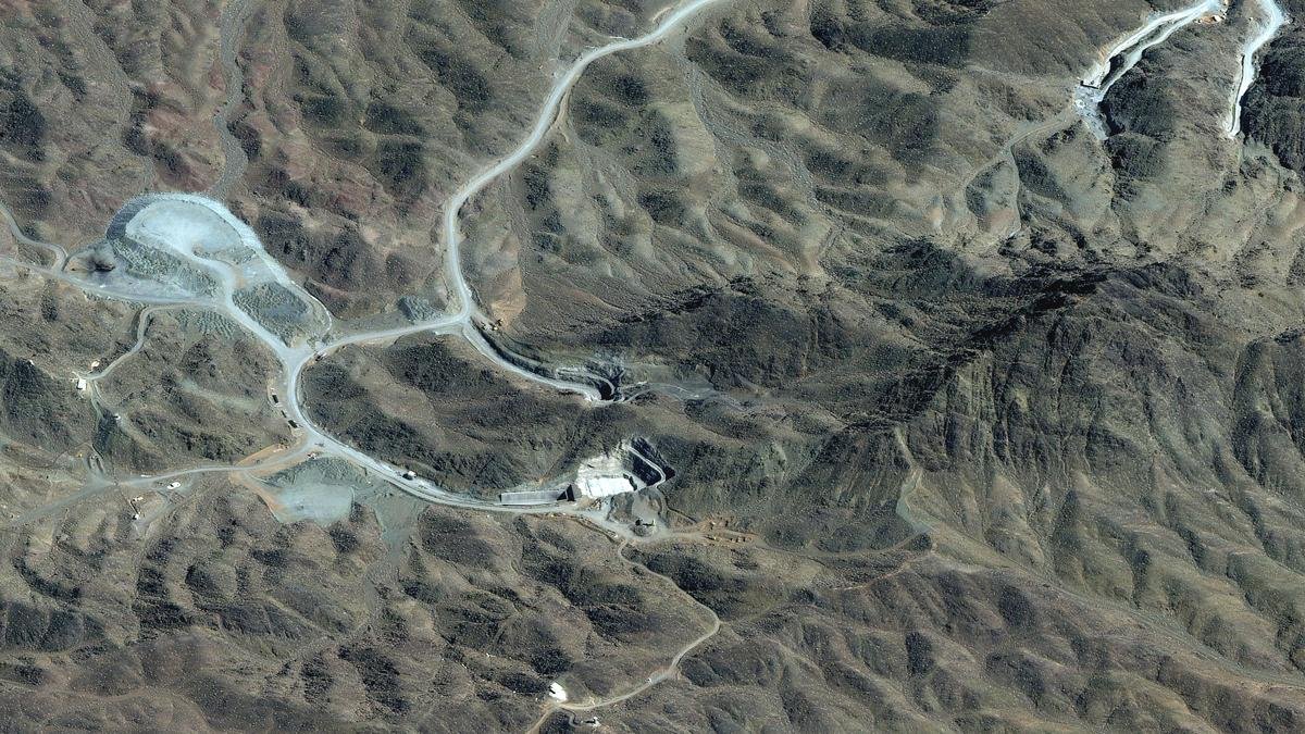
A satellite image shows an overview of the Pickaxe Mountain tunnel complex in Natanz, Iran.
| Photo Credit: Reuters
Profile
“We’ll be hitting that area very probably pretty soon, and there’s not a thing they can do about it,” U.S. President Donald Trump recently said about Pickaxe Mountain, a geological formation around 220 km south of Tehran.
The locals call it Kuh-e Kolang Gaz La. Recent satellite images showed a flurry of activity around the formation, including the movement of vehicles, and entrances to what appear to be tunnels. What is under the mountain is not clear, although Israeli intelligence seems to believe it houses a part of Iran’s nuclear programme.
Pickaxe Mountain is part of the Karkas Range, or Reshteh Kuh-e Karkas. It extends for more than 100 km in a northwest-southeast ‘diagonal’ between the cities of Kashan and Ardestan and is named for its highest summit, Mount Karkas, which rises to about 3.9 km above sea level in the midst of an arid plateau. The Range is part of the Urumieh-Dokhtar magmatic belt, and its mountains hold evidence of millions of years of volcanic activity and tectonic deformation. Specifically, the Urumieh-Dokhtar belt developed as the Neo-Tethyan Ocean subducted beneath the Iranian continental margin before Arabia finally collided with Eurasia, in the last 66 million years.
The tectonic activity generated large quantities of calc-alkaline magma and thick lava flows and the attendant accumulations of volcanic breccia and ash deposits. Thus, much of the bedrock exposed in the Karkas Range consists of volcanic rocks such as andesite and rhyolite together with pyroclastic deposits and younger sedimentary units.
A 2019 study led by Panthea Giahchi of the Geological Survey and Mineral Exploration of Iran (GSMEI) reported that the landforms of the Karkas massif were shaped by rock type and climate together. The range sports steep ridges, landslide deposits, rockfalls, and extensive alluvial sediments. Andesite rocks generally form dense and mechanically strong masses and rhyolite rocks often (though not always) host many fractures.
According to some regional GSMEI maps, the Range is also dissected by numerous faults, creating a structurally complex formation. This is why understanding how specific parts of the Range will respond to missile strikes and explosions is complicated.
Volcanic landscape
Within this craggy volcanic landscape sits Pickaxe Mountain, in the form of a ridge just south of Natanz. Despite its prominence, there appear to be no peer-reviewed geological studies of the mountain: most assessments in the public domain are based on geological maps and satellite data, and details extrapolated from what is known about the Karkas Range itself. GSMEI maps indicate that Pickaxe Mountain also consists of volcanic rocks such as andesite, rhyolite, dacite, and their associated pyroclastic units — and with variations in the lithology, density of fractures, faulting patterns, weathering, and groundwater intrusion together affecting its mechanical characteristics. Andesites, rhyolites, and volcanic tuffs transmit seismic and shock waves differently from one another. The fault zones also create planes of weakness that in turn influence the stress response of the adjacent rock mass.
Geological uncertainty is often pronounced in projects involving volcanic rocks. To excavate Pickaxe Mountain itself, local experts might have characterised the rock units, charted their fractures and faults, tested their mechanical properties in the lab, and only then planned the excavation.
But as much as volcanic rocks complicate an excavation, they could complicate a bombing as well. Intact andesite, dacite, rhyolite, and basalt often require more energy than many sedimentary rocks to fracture. And while natural fractures sound like flaws, they can scatter stress waves by splitting the energy up among many discontinuous formations.
In fact, Pickaxe Mountain may be a symbol of Iran’s geo-strategic riches. Its volcanic geology could make deep penetration more difficult. Any ground campaign would have to navigate a rugged landscape. And the surrounding maritime network has three major chokepoints — the Straits of Hormuz and Bab el-Mandeb and the Suez Canal — giving Iran and its allies outsized opportunities to disrupt maritime traffic.
Published – July 26, 2026 02:04 am IST


