


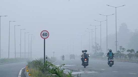
New Delhi: In a rare April occurrence, parts of Delhi-NCR were enveloped in haze or shallow fog on Saturday morning, with experts attributing the unusual phenomenon to a combination of recent spells of rain, falling night temperatures and high moisture that created condensation near the surface in the early hours.

")
Experts said the misty start to the day was the result of multiple factors interacting over the past 48 hours.
ALSO READ | Back-to-back western disturbances bring rain spell in northwest; Delhi in for cloudy, breezy days
Mahesh Palawat, president at Skymet Weather, said that light rain on Friday increased moisture levels, while a slight dip in temperatures and relatively clear skies overnight were conducive for condensation and shallow fog. “Hazy conditions were seen in parts of Delhi NCR as the temperature reduced and it rained over the past couple of days. So, there was heavy moisture in the air along with clear skies that led to such a morning that may sometimes occur during March-April,” he said.
Delhi recorded a minimum temperature of 20.7 degrees Celsius (°C) on Saturday, which was 1.9 degrees above normal, but still low enough under moist conditions to aid fog formation. The India Meteorological Department (IMD) also noted that recent western disturbances and associated clouding played a role in moderating temperatures and influencing humidity levels.
Despite the foggy start, the day progressed into a relatively mild and pleasant afternoon, with temperatures remaining below typical early-April levels. The maximum temperature was 32°C, about 2 degrees below normal, continuing a trend of subdued daytime heat in the Capital.
Rain activity, however, remained limited through the day. Safdarjung, which serves as the city’s base weather station, recorded just 0.5mm of rainfall in the 24 hours ending Saturday morning. Localised variations were observed, with Ayanagar clocking 5.8mm of rainfall during the same period. IMD said Delhi recorded light to very light rainfall at most places over the preceding 24 hours, accompanied by gusty winds and cloudy skies.
IMD, in its latest forecast, also said, “Delhi is likely to continue experiencing relatively mild conditions over the next few days, with intermittent cloud cover and chances of light rain or thundershowers likely in the evening on Sunday.”
Palawat, however, said that daytime temperatures were likely to increase on Sunday and Monday, with the next spell of rain likely only on Monday night, due to a fresh western disturbance that will impact cyclonic circulation in the area.
“The active western disturbance is expected to impact northwest India around April 7 and 8, potentially bringing a fresh spell of rainfall Monday night onwards, with thunderstorms and gusty winds across Delhi-NCR,” said Palawat.
IMD has also indicated that temperatures are likely to remain near-normal to below-normal for most of the next week, delaying the onset of typical early summer heat.
Meanwhile, air quality in Delhi recorded a sharp improvement on Saturday, coinciding with the change in weather conditions. The air quality index (AQI) dropped from 266 (poor) on Friday to 137 (moderate), according to the Central Pollution Control Board’s daily bulletin. Experts attributed the AQI improvement to a combination of various meteorological factors.


