


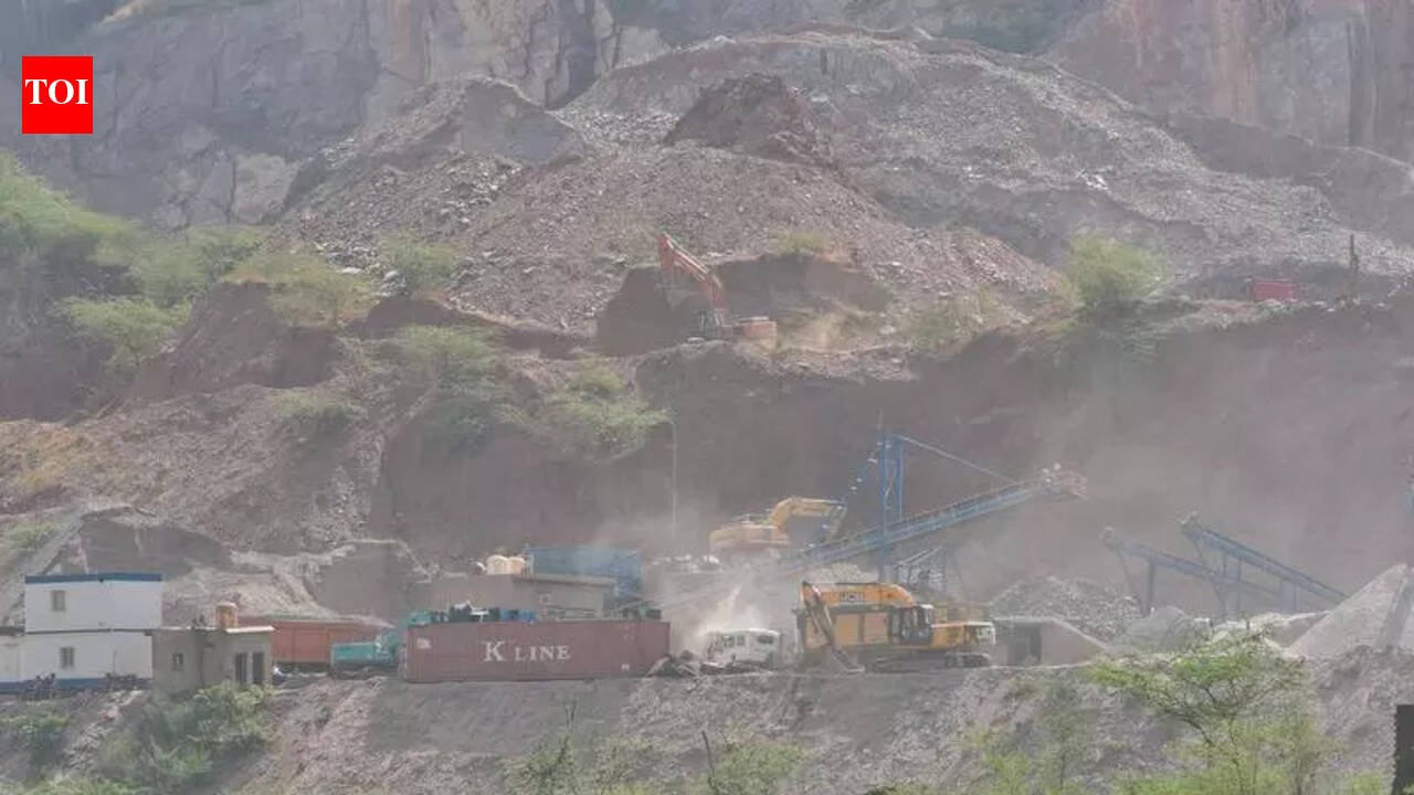
Gurgaon: The Nuh district administration has begun carrying out drone mapping to track fresh violations and changes on the ground in the Aravalis, even as the region continued to tackle illegal mining in eco-sensitive pockets of the Aravali belt. Nuh deputy commissioner Akhil Pilani told TOI that the exercise is meant to create a visual baseline and help detect even small-scale excavation or new access routes early. “We have tied up with Driishya Haryana for drone mapping. We carried out the mapping of the Aravalis. We plan to carry it again in three months to compare the images,” Pilani said.Officials said the periodic aerial surveys will focus on vulnerable stretches of the Aravali Range in and around Nuh, especially Basai Meo and adjoining villages, which have seen repeated allegations of illegal stone and soil extraction.The move follows last year’s controversy in Basai Meo, where a hillock was razed and informal roads were carved out to ferry mined material across the Haryana-Rajasthan border. Residents then complained of trolleys entering villages, loading material, and leaving before enforcement teams could reach the spot. Joint inspections by forest, mining, and enforcement agencies failed to catch operators on site, underlining the difficulty of policing rugged terrain through conventional means.In a parallel effort to physically block mining corridors, authorities last year converted two illegal roads in Basai Meo into green zones by planting around 7,500 saplings over a 15 km ridge stretch. Forest officials said the rapid afforestation drive was designed not just as ecological restoration but as a permanent barricade against vehicle movement into sensitive hill areas repeatedly exploited by mining operators.


