



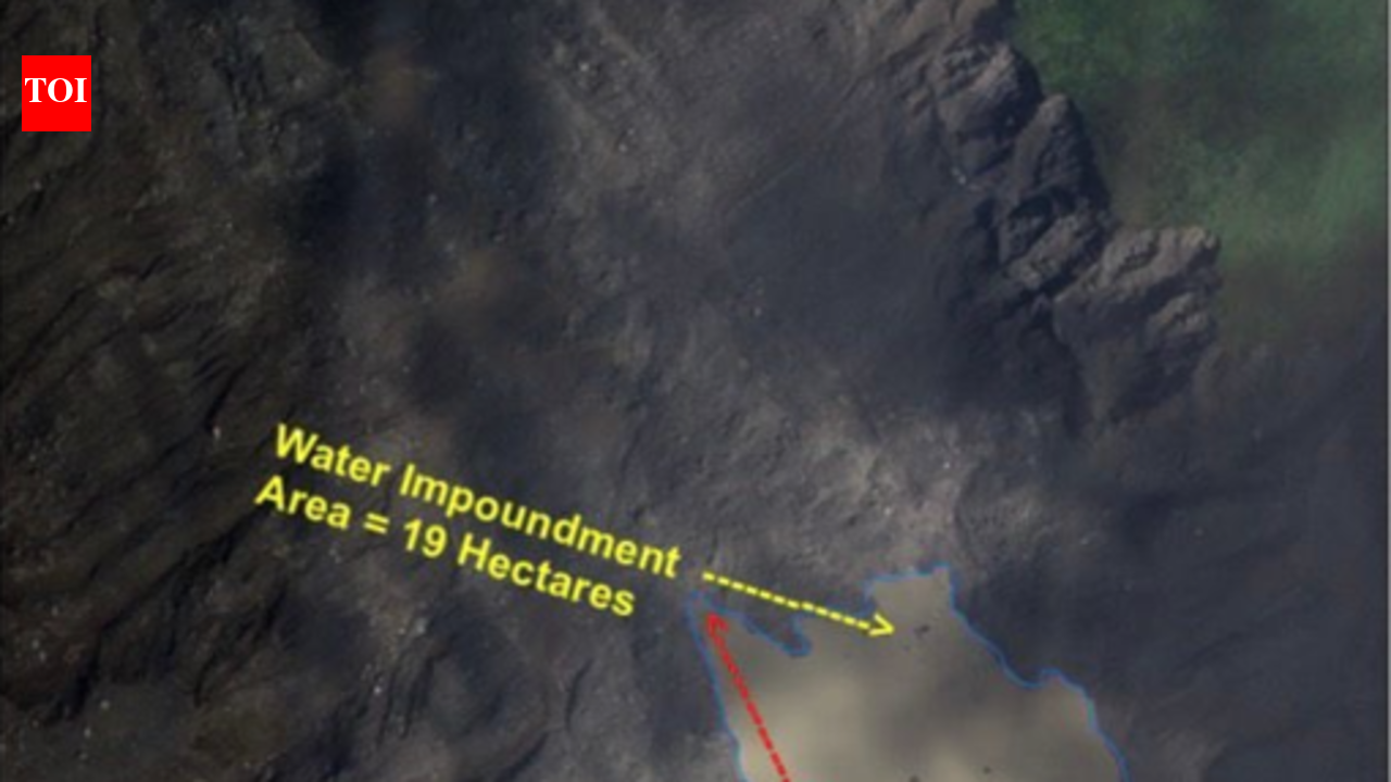
Hyderabad: Days after the avalanche struck the Nepal’s Langtang Lirung mountain range, satellite images have revealed that the disaster reshaped local drainage patterns, leading to the formation of two new water bodies in the rugged Himalayan landscape.The findings come from Hyderabad-based National Remote Sensing Centre (NRSC), which analysed high resolution imagery captured by ISRO’s Cartosat-3 satellite during its morning pass on Aug 28 and compared it with pre-event PlanetScope imagery from Aug 25, a day before the avalanche struck Rasuwa district.The satellite assessment shows that the avalanche and the massive movement of ice, rock and debris disrupted natural drainage channels in the affected terrain, leading to water accumulation at two separate locations, one near the glacier and ice rock avalanche zone and another near a river confluence downstream.According to NRSC, the larger of the two newly-formed water bodies covers an estimated surface area of 19 hectares, stretching roughly 623 metres in length and 450 metres in width.The second impoundment spans around 11 hectares and is more elongated in shape, extending nearly 944.6 metres along the valley while measuring about 236 metres at its widest point.Together, the two water bodies occupy nearly 30 hectares.Satellite imagery suggests the larger impoundment has formed in a broad depression created in the disturbed terrain, while the second has developed along an existing drainage channel. The pattern indicates that avalanche debris has obstructed or altered water flow at more than one location.No immediate dangerWhile the new impoundments are currently small and do not pose an immediate threat, experts say continued monitoring is essential to track their evolution.In steep Himalayan terrain, accumulations of ice, rock and debris can temporarily block natural drainage systems, allowing water to build up behind unstable barriers. Changes in these formations can occur rapidly depending on inflows, weather conditions and erosion.NRSC said the Aug 28 Cartosat-3 imagery provides a crucial baseline for future assessments. Subsequent satellite observations can be compared with the current measurements of 19 hectares and 11 hectares to determine whether the impoundments are expanding, stabilising or draining.Any sharp increase in water spread, erosion of the debris barriers or sudden release of stored water could have implications for downstream areas.The Aug 25 pre-event imagery, though partially obscured by cloud cover, provides the closest available satellite reference for assessing how the landscape changed following the avalanche.


