



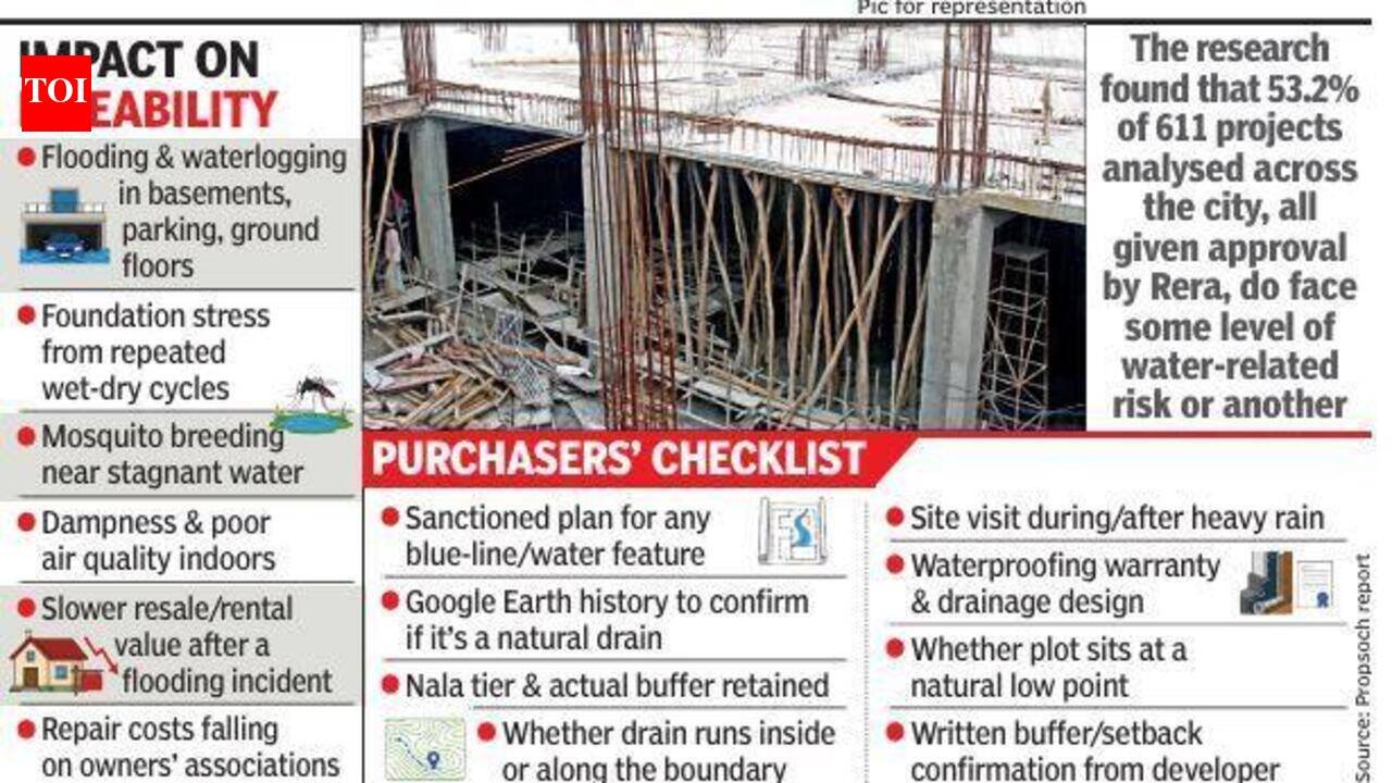
Bengaluru: More than half the city’s residential projects launched over the past five years carry some form of water-related site risk, according to a new study by Propsoch Research, highlighting a concern that often becomes apparent only during monsoon.The study analysed 611 Real Estate Regulatory Authority-approved housing projects across 69 micromarkets, covering areas such as Koramangala, Jayanagar, Whitefield, Sarjapur Road, Hebbal, Yelahanka, Electronics City, and Kanakapura Road. It found that 45% (275) of the projects are located on or adjacent to a stormwater drain (SWD), locally known as a nala, while another 8.2% (50) are built on low-lying land vulnerable to waterlogging despite not being near a drain. Together, 53.2% of the projects face some level of water-related risk.Among the 275 projects near nalas, 179 (29.3%) are located along tertiary nalas, the smallest category, with only two classified as high impact. Another 77 projects (12.6%) are near secondary nalas, of which 57 carry high-impact flags, while 19 projects (3.1%) are along primary nalas, with 14 marked as high impact.The report found that smaller drains are more likely to pass through a project’s layout than larger ones. Only 31.6% of primary-nala sites have the drain running within the project, compared with 60.3% of tertiary-nala sites. This means smaller channels are more often incorporated into common areas, making them harder for homebuyers to identify during site visits.Although most projects are located near tertiary nalas, the highest risks are concentrated around primary and secondary nalas. The findings suggest that the larger the drain, the greater the likelihood of significant water-related hazards, even if relatively fewer projects are situated nearby.Problem with topographyAccording to the report, Bengaluru’s topography contributes to the issue. The city sits on a ridge dividing three valleys, with its SWDs following these natural contours. As a result, corridors such as Sarjapur Road-Bellandur-HSR Layout and Hebbal-Thanisandra-Yelahanka are more likely to intersect drainage channels.The report stressed that proximity to a nala does not automatically mean a property will flood. A well-engineered drain with an adequately maintained buffer can function safely. However, researchers said such site-level information is rarely disclosed to buyers before purchase.“Buyers in Bengaluru study the home in enormous detail: the price, builder, floor plan, carpet area. What almost no one is taught to study is the ground it stands on, and what happens to that ground in monsoon season,” said Ashish Acharya, founder and CEO of Propsoch. “A site that looks perfect in Dec can be a very different home in the middle of monsoon, and by then the buyer has usually already signed.”Matter of executionExperts called for comprehensive public mapping of SWDs with stricter enforcement of building regulations.Shrikant S Channal, president of Karnataka Council of Professional Civil Engineers, said engineers can safely design structures near nalas, rivers or hills, but weak enforcement remains the real problem. “Under the National Building Construction Standards, every project must undergo planning, geotechnical investigation, structural and service design before construction. Authorities must obtain engagement and completion certificates before issuing OC. Though these provisions have existed for years, they are rarely enforced,” he noted.Water conservation expert Vishwanath S suggested publicly mapping rajakaluves, buffer zones, and high flood lines, similar to Pune’s white-line and blue-line system, to help buyers make informed decisions.


