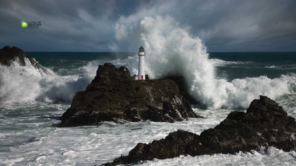
Western Europe witnessed a powerful chain of Atlantic storms this month, leaving fatalities, widespread power cuts, and infrastructure and agricultural damage. But what made this episode particularly striking was not a single catastrophic landfall, but a sequence of systems tracking along a similar corridor. It repeatedly struck France before sweeping into the Iberian Peninsula. Resultantly, the cumulative impact has been severe.
France: High Winds, Flood Alerts, and Mass Power Outages
France absorbed the first and most violent phase of the storm sequence. Wind gusts reached 162 km/h in Biscarrosse, 145 km/h in Pau, and over 130 km/h in Toulouse. These winds were strong enough to overturn heavy vehicles, rip roofing from buildings, and bring down thousands of trees.
At the height of the disruption, approximately 900,000 households lost electricity. Emergency crews worked around the clock to restore supply, deploying thousands of technicians across affected regions. Even after winds eased, river systems remained under pressure, with flood alerts continuing in multiple departments as swollen waterways responded to days of sustained rainfall.
Tragically, the storms claimed lives. Fatal incidents included vehicle-related accidents during extreme winds and storm-related infrastructure failures. Beyond the immediate toll, the economic cost from fallen power lines, damaged property, and transport disruption is expected to run into hundreds of millions of euros. However, the system did not stop at France’s borders.
Portugal: Flood Fears and Infrastructure Collapse
As the storm energy shifted southwest, Portugal experienced prolonged rainfall that compounded existing ground saturation. River basins, already stressed from previous weather systems, rose rapidly.
In the Coimbra region, authorities monitored water levels closely amid fears that dams and riverbanks could exceed safe limits. Thousands of residents were placed under evacuation advisories as precautionary measures. In some municipalities, evacuations were carried out as floodwaters encroached on residential areas.
Moreover, the damage extended beyond surface flooding. A section of motorway infrastructure reportedly collapsed under the strain of saturated ground and water pressure, highlighting the structural vulnerability that can follow prolonged rainfall rather than short bursts of extreme intensity.
Across Portugal, recent storm impacts have been severe:
- At least 16 fatalities linked to storm systems in recent weeks
- Tens of thousands of power outages during peak impact periods
- Estimated damages approaching €775 million
These figures reflect not a single weather event, but a pattern of recurring Atlantic lows striking the country in quick succession.
Spain: Fatalities and Agricultural Damage
Spain faced both wind damage and flood-related consequences as the storm track moved eastward.
Unfortunately, in Catalonia, a 46-year-old woman died after being struck by debris amid powerful winds. Emergency services also responded to structural collapses and falling objects in urban areas.
Beyond immediate hazards, the storms have delivered a quieter but economically significant blow to agriculture. Officials estimate that approximately 14,000 hectares of crops have been affected, including citrus groves, berry farms, and olive plantations. Many of these crops were already vulnerable following months of above-average rainfall.
Since October, parts of Spain have recorded nearly 38% more rainfall than seasonal norms, leaving soils saturated and increasing susceptibility to runoff and river overflow. When it comes to the agricultural regions, prolonged waterlogging can damage root systems, reduce yields, and delay harvest schedules well beyond the storm period itself.
The Meteorological Pattern: A Reloading Atlantic Corridor
The underlying driver of these storms was a powerful Atlantic jet stream steering low-pressure systems directly toward western Europe. Rather than dissipating after landfall, the pattern repeatedly regenerated, sending successive depressions along a similar path.
This type of configuration creates what meteorologists sometimes describe as a “storm train” — a sequence of systems following one another with limited recovery time in between.
Key characteristics of this pattern included:
- Strong pressure gradients producing damaging wind gusts
- Deep Atlantic moisture feeding sustained rainfall
- Saturated soils amplify flood response
- River systems are unable to recover between systems
When catchments remain saturated, each additional rainfall event produces a faster and more aggressive hydrological response. Flood risk escalates even if subsequent rainfall totals are moderate.
A Broader Climate Context
It seems to be usual for Western Europe to face Atlantic storms during winter. However, warming sea surface temperatures increase atmospheric moisture availability, raising the potential for heavier precipitation within these systems.
A warmer atmosphere can hold roughly 7% more water vapor per degree Celsius of warming. While no single storm can be directly attributed to climate change, the probability of intense rainfall and compounding multi-system sequences increases in a warmer climate.
This month’s storms illustrate how cumulative impact, rather than single extreme peaks, may define future risk. Repeated moderate-to-strong systems can produce damage equivalent to, or greater than, a single exceptional event.
What Happens Next?
With rivers still elevated and ground conditions fragile, secondary risks remain, including:
- Delayed landslides in saturated hillside regions
- Structural weaknesses in flood defenses
- Additional runoff if new Atlantic systems develop
- Continued stress on agricultural recovery
Recovery efforts will focus not only on restoring power and clearing debris, but on reinforcing infrastructure resilience against recurring winter storm corridors.
The events across France, Portugal, and Spain serve as a reminder that Europe’s weather extremes increasingly involve persistence. Not merely a storm, but a sequence. Not just wind, but compounding rainfall, saturated terrain, and strained systems operating at their limits.
