


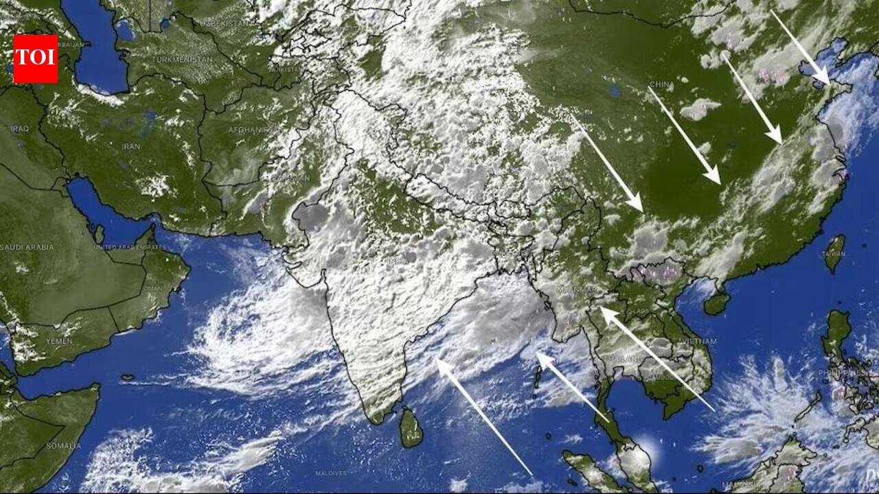
Kolkata: A massive 7,000 km-10,000-km-long ‘rain belt’ stretching from northern India across the Himalayas, China and into South Korea — which has contributed to the current rainy spell in Kolkata and east India — is about to get fragmented into smaller low-pressure zones by July 31. Also called a ‘monsoon convergence zone’ or a ‘shear zone’, which is a thick and long column of cloud, it will gradually dissipate, paving the way for the return of the El Nino effect that could reduce rainfall significantly, meteorologists said.While El Nino usually suppresses monsoon rainfall across South Asia by altering Pacific ocean atmosphere circulation, a strong intra-seasonal surge — like this massive monsoon convergence zone — can effectively override El Nino’s drying effects on a regional scale. Warm, moisture-rich winds from the Indian Ocean interacting with mid-latitude weather systems have delivered 170%-180% of normal daily rainfall across India during this surge.
CJP Jantar Mantar Protest Updates
While the convergence zone has led to enhanced rain in east India, local factors, too, were responsible, said the Regional Meteorological Centre. “Such zones are common in monsoon. We have seen such cloud formations in peninsular India in recent years. Since a low-pressure area and the monsoon trough are now active over Bengal, the impact of the convergence zone is negligible now. But without local factors, it would have an impact,” said H R Biswas, deputy director-general of meteorology.The monsoon trough and a low-pressure area across the Bengal-Odisha coast and adjoining Bay of Bengal are now triggering moderate to heavy rain across south Bengal. Low-pressure systems forming in the Bay of Bengal are channelling huge volumes of moisture into east India. As a result, Kolkata and nearby districts, including North and South 24 Parganas, Howrah, and East and West Midnapore, are experiencing active, persistent monsoon spells, turning seasonal rainfall deficits into healthy totals.The unbroken, 10,000-km cloud band will begin to fragment in four-five days, said weather scientists. Rather than vanishing overnight, the continuous corridor will split into localised, isolated low-pressure systems and rain pockets across China, India and the Korean Peninsula.“It doesn’t eliminate the global ocean condition of El Nino itself. Rather, regional dynamics, like an active monsoon trough and Bay of Bengal low-pressure systems, have temporarily taken control of atmospheric moisture delivery. It is indeed contributing to more rainfall in Kolkata, south Bengal and east India, though local factors are stronger,” said a weather scientist.The convergence was generated when moisture-heavy southwesterly winds from the Indian Ocean collided with active low-pressure systems and upper-level jet streams across East Asia, creating a continuous corridor of rain-bearing clouds spanning thousands of kilometres.The India Meteorological Department (IMD) forecasts active to vigorous monsoon conditions across North, East and Northeast India to continue intensely over the next 3-5 days.Active monsoon activity across Bengal and Eastern India is expected to remain sustained through late July and into the first week of Aug 2026.
